Be part of a great project in Caboolture
One way we can encourage more people to ride bikes in Caboolture is by creating a trail along the river bank of the Caboolture River.
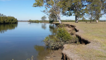
The river’s banks will flood on occasion and be too soft to be built on or farmed so it’s perfect for a bike trail for everyone to enjoy!
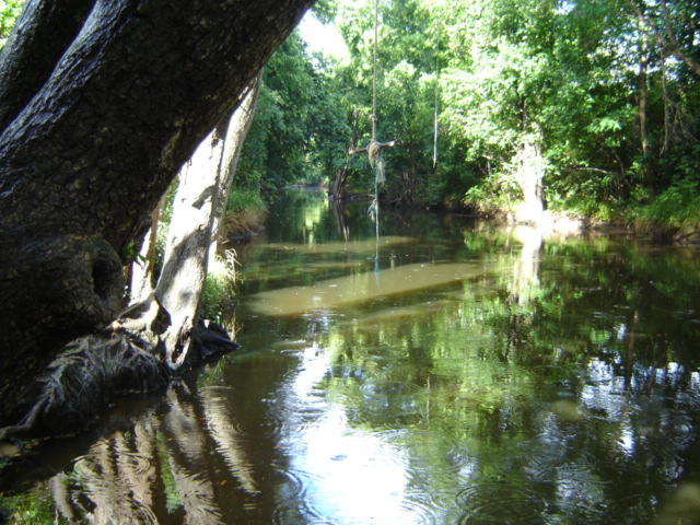
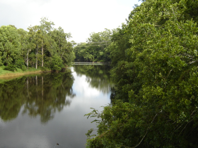
Pam and Geoff Roberts have kayaked the river for decades and shared these images to encourage people who’d like to participate in making the Caboolture River Bike Trail happen. If this looks like a project that you will feel proud of, join us to create the Caboolture River Bike Trail so we can all enjoy it to kayak or ride a bike, a wheelchair, scooter or walk along.
We currently have a planner, a nature photographer and lots of enthusiasm. Whatever skills you’d like to bring or develop, you’re welcome to join us. All you need to do is go to the Contact page and send us a message.
Lakes area is the freshwater lake east of Morayfield Road, which joins to the Caboolture River. This area was used by groups such as scouts and Morayfield High School for recreation and training. It extends west to the old pumping station (behind the new police station). This area is separated from the rest of the western Caboolture River by a water pipe which is positioned just above water height and prevents through passage by kayak / canoe.
Saltwater River is anywhere east of the weir – roughly under the railway line. The river here is tidal and extends to its mouth at Beachmere. The Caboolture River weir holds back a lovely pool of fresh water that has been collected from as far away as Campbells Pocket on the D’Aguilar Range, 27 kilometres upstream. It is a sanctuary for fish, birds, and people who want to experience Caboolture in a way that only a paddler can.